From detecting potholes to categorizing cracks and assessing overall road health, RoadEye AI enables smarter decisions to optimize infrastructure maintenance and safety.
Revolutionizing Road Defect Monitoring with Artificial Intelligence
RoadEye AI identifies, categorizes, and prioritizes road defects in real-time, ensuring efficient maintenance and enhanced public safety.
Collect
Mount a smartphone and collect data via our AI ML models.

Analyze
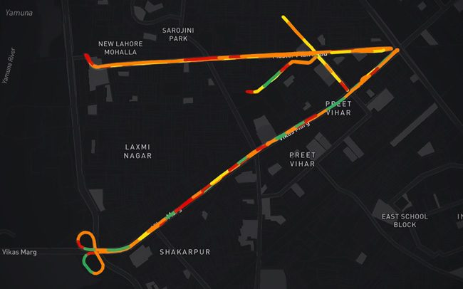
The collected data is plotted into intuitive, interactive map.

Export
Export geo-referenced points and segments as geoJSON files or download in CSV form.

High-Resolution Coverage
High-Resolution Coverage
Automatically captures high-quality images at 10-foot intervals

Precise Tracking
Precise Tracking
Accurately log the GPS location of every road segment with advanced GPS-enabled technology

Broad coverage
Broad coverage
Monitor extensive road systems efficiently, including urban streets, highways, and rural routes, with comprehensive reach.

Real-Time
Real-Time
Access up-to-date road conditions and insights with data refreshed and processed in near real-time.
Discover more
Map Agnostic
Map Agnostic
Effortlessly integrate with existing GIS platforms, mapping systems, and other spatial data tools without compatibility issues.

Global Standardization
Global Standardization
Designed to meet the needs of any road network, anywhere in the world, with consistent and reliable results.

-
High-Resolution Coverage
-
Precise Tracking
-
Broad coverage
-
Real-Time
-
Map Agnostic
-
Global Standardization
High-Resolution Coverage
Automatically captures high-quality images at 10-foot intervals

Precise Tracking
Accurately log the GPS location of every road segment with advanced GPS-enabled technology

Broad coverage
Monitor extensive road systems efficiently, including urban streets, highways, and rural routes, with comprehensive reach.

Real-Time
Access up-to-date road conditions and insights with data refreshed and processed in near real-time.
Discover more
Map Agnostic
Effortlessly integrate with existing GIS platforms, mapping systems, and other spatial data tools without compatibility issues.

Global Standardization
Designed to meet the needs of any road network, anywhere in the world, with consistent and reliable results.

RoadEye Index (REI)
The RoadEye Index (REI) provides a comprehensive road quality assessment using a simple yet powerful rating system. Each road segment is assigned a color-coded rating from 1 to 5, where 1 indicates excellent condition and 5 highlights severe deterioration.
Key features of the REI:
• Color-Coded Ratings: Quick visual understanding of road quality for easy prioritization.
• Chainage and Bearing Integration: Pinpoint precise locations of defects for targeted repairs.
• Actionable Insights: Helps prioritize maintenance tasks and allocate resources effectively.
Anonymization
The RoadEye AI prioritizes privacy while delivering unparalleled precision in road defect monitoring. All non-road-related entities, such as vehicles, pedestrians, and surroundings, are anonymized and blurred to maintain confidentiality. The system exclusively focuses on analysing road-specific elements, including paved surfaces, defect types, repairs and road assets.


